Longitude/Latitude Coordinates for Hahn AB, Germany
I have attempted to describe how these areas were/are utilized since the MACE system left Hahn in 1966. For those folks who use Google Earth, these coordinates will allow them to zoom down to see the sites/areas as they are today. Posting these on the TAC Missile Site should be interesting to all the old Hahn gang.
Respectfully, Dave Maas
Hahn AB, 38th TMW Sites and Support Areas
Site IV – 49 ° 59’ 57.9” North 7 ° 24’ 00.77” East
(The old Site IV facilities are now used by the German military as a storage area.)
Site V – 49° 54’ 47.7” North 7° 24’ 46.7” East
(The old Site V facilities were used as a training area for front end loader operators.)
Site VI – 50° 02’ 38” North 7° 25’ 35.9 East
(In the mid 1980s, Site VI became a GLCM Sit “Wuescheim”. The GLCM site is now transformed into an Amusement Park.)
Metro Tango – 50° 00’ 52.5 North 7° 22’ 56.02 East
(During the 1980s, this was used by the USAF as a Special Communications Site. I have no idea what it is used for today.)
Weapons Storage Area – 50° 00’ 43.79’ North 7° 24’ 03.00 East
(It seems that this site is still being used as a storage area, possibly by the German military.)
586 Maintenance Area – 49° 57’ 39.08 North 7° 17’ 09” East
(Looks like this area is being used as a storage area.)
38th TMW Barracks Area – 49° 56’ 12.7 North 7° 15’ 55.47 East
(Some of the barracks were remodeled to become a Motel to support HAHN Airport.)
Longitude/Latitude Coordinates for Sembach AB, Germany
Sembach AB 38th TAC Missile Wing and Mace A launch sites
Sembach AB Administrative – Missile Maintenance – Housing Area
49° 31′ 39.75″ north 7° 51′ 59.92″ east elev 1160
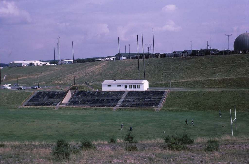
(38th Tac Missile Wing Command Post Operations Bunker was located under the Football field bleachers seen in this photo. Call sign Cap Gun)

Sembach AB Flight Line
49° 30′ 29.01″ north 7° 51′ 41.32″ east elev 1051
Site I ( Mehlingen ) 822nd – call sign Char Girl
49° 28′ 16.33″ north 7° 50′ 55.47″ east elev 944
Site II ( Enkenbach – aka Fischbach) 823rd – Call sign Invent
49 ° 28’ 06.2”north 7° 53′ 53.38″ east elev 1190
Site III ( Grünstadt ) 887th – call sign Hacksaw
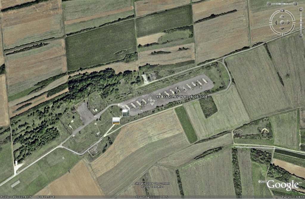
49° 33′ 27.91″ north 8° 08′ 05.13″ east elev 1038
Site III my work place and home for 4 1/2 years!
(After more that 50 years of U.S. military activity, both Air Force and Army, as of April 2006 this site known by many names such as (The Hill, Hell’s Hill Top, Comm Site of many numbers and many names, Combat Site III, C Flight 822nd and the 887th) has been returned to the German government. It last served as a paint ball arena run by a U.S. Army org. out of Mannheim.) I last went by the site in December 2006 and the site stood then as it looks in the Google Earth picture now.

Robert Bolton


